
History of the Atlantic Cable & Undersea Communications
from the first submarine cable of 1850 to the worldwide fiber optic network
Submarine Cable Route Maps
|
History of the Atlantic Cable & Undersea Communications |
|
Submarine Cable Route Maps |
|
Early cable route maps were often published in the cable history books. Later maps were issued as promotional items by cable companies and government telecommunications authorities. For modern cables, Greg Mahlknecht has an excellent interactive map showing routes and details for each system. TeleGeography now has an antique-style interactive map of present-day working cables. The TeleGeography site also has other submarine cable maps. Each image below links to a larger copy of the map |
|
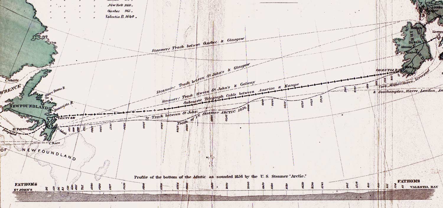
Vertical section of the bed of the Atlantic Ocean, |
|
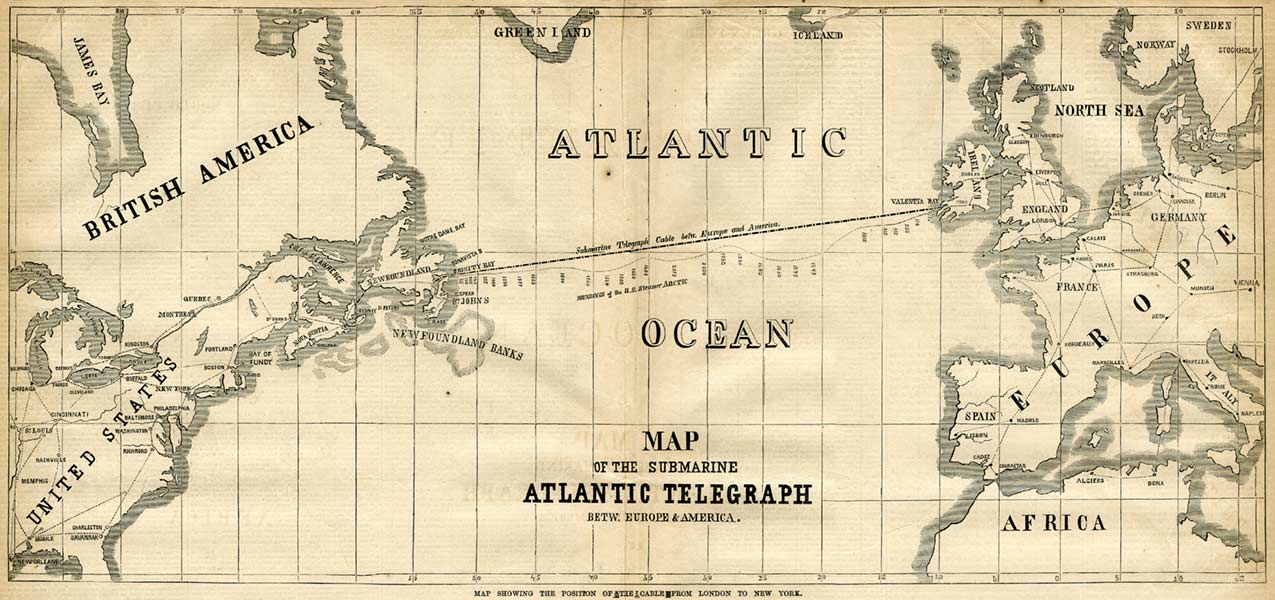
Map of the 1858 Atlantic Cable route from |
|
Another map of the 1858 Atlantic Cable route. Detail of above map |
|

Map of the Telegraph Plateau, from Maury's Physical Geography of the Sea (1869 edition), showing the routes of the 1858 Atlantic Cable and the proposed 1869 French cable |
|
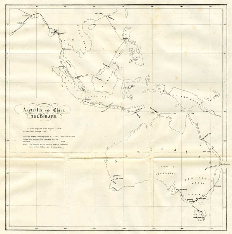
Australia and China Telegraph, 1859 |
|
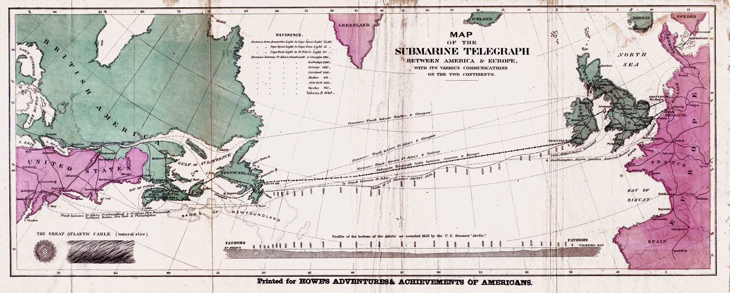
1865: Map Shewing the Atlantic Telegraph
and other Submarine Detail of North Atlantic section of above map |
|
|
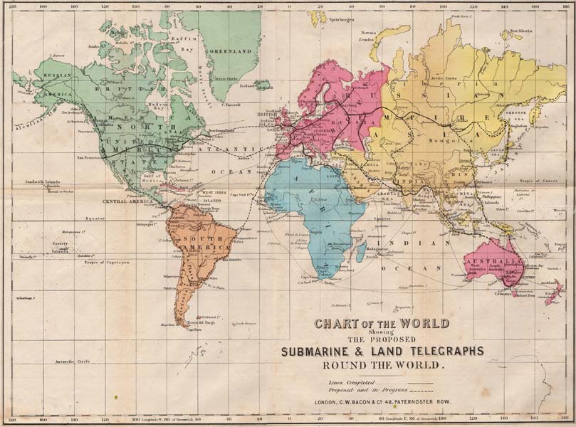
1865: Chart of the World Showing the Proposed
Submarine & Land |
|
|
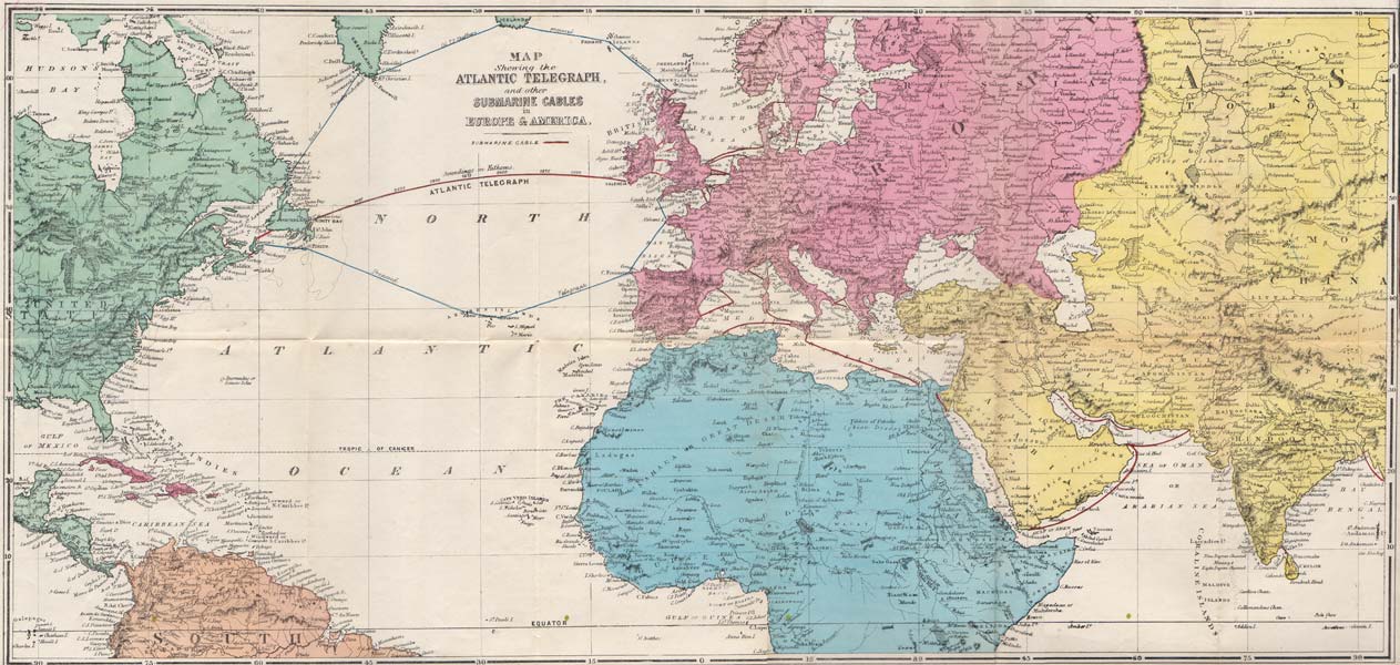
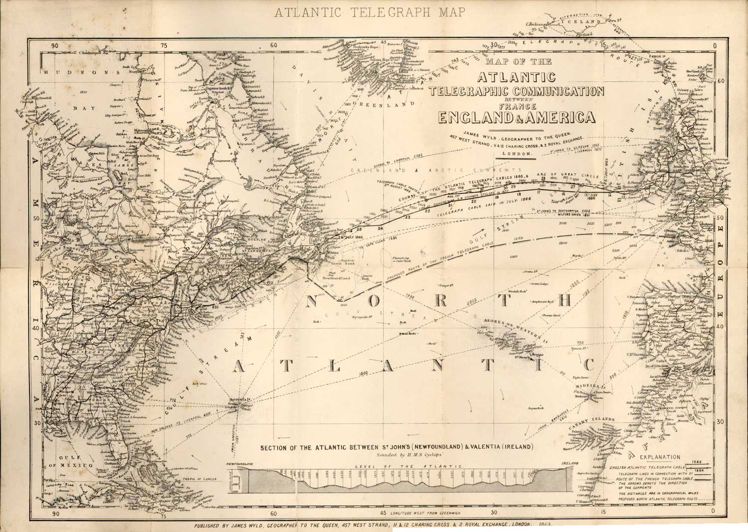
1869: Map of the Atlantic Telegraph Communications between France, England & America |
|
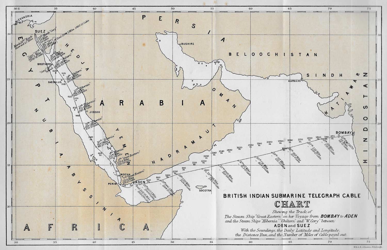
1870 British Indian Cable |
|
|
North Atlantic detail of above map c. 1870/71 Map showing the telegraph lines in operation, under contract, and contemplated, to complete the circuit of the globe / entered according to Act of Congress in the year 1855 by J.H. Colton & Co. in the Clerks Office of the District Court for the Southern District of New York. 41cm x 63cm. Image courtesy of the Library of Congress, call number G3201.P92 1855 .J51 Note: This Colton world map is dated 1855, but it was re-issued about 1870 with the cable lines added, together with a new title and caption. Evidence for this is that one submarine cable, from France to North America, is shown as “in operation;” this cable was laid in 1869. A copy of this map from the Bill Holly Archive has the signature of Cyrus W. Field on the reverse. |
|
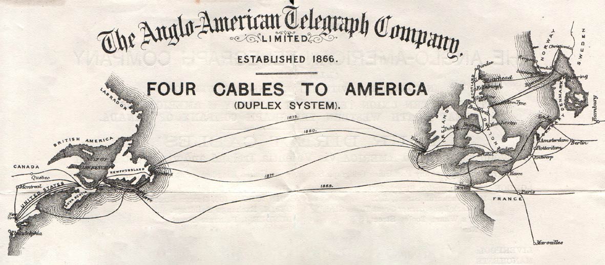
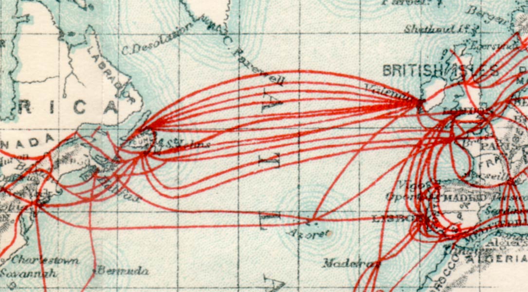
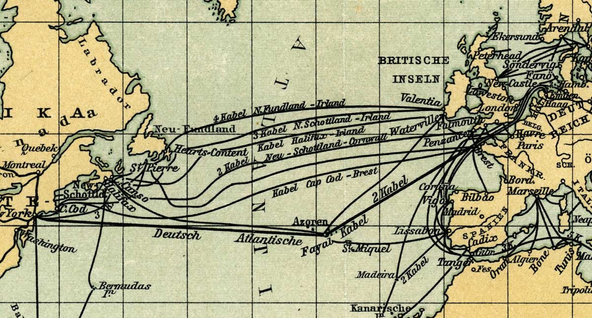
c. 1880 Anglo-American Telegraph Company North Atlantic map |
|
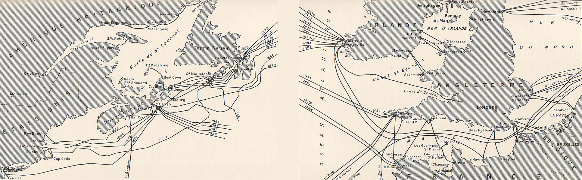
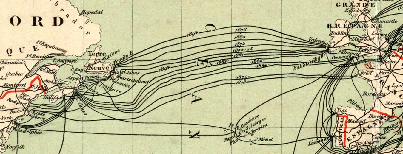
1893 map of North Atlantic cables (center section omitted), |
|
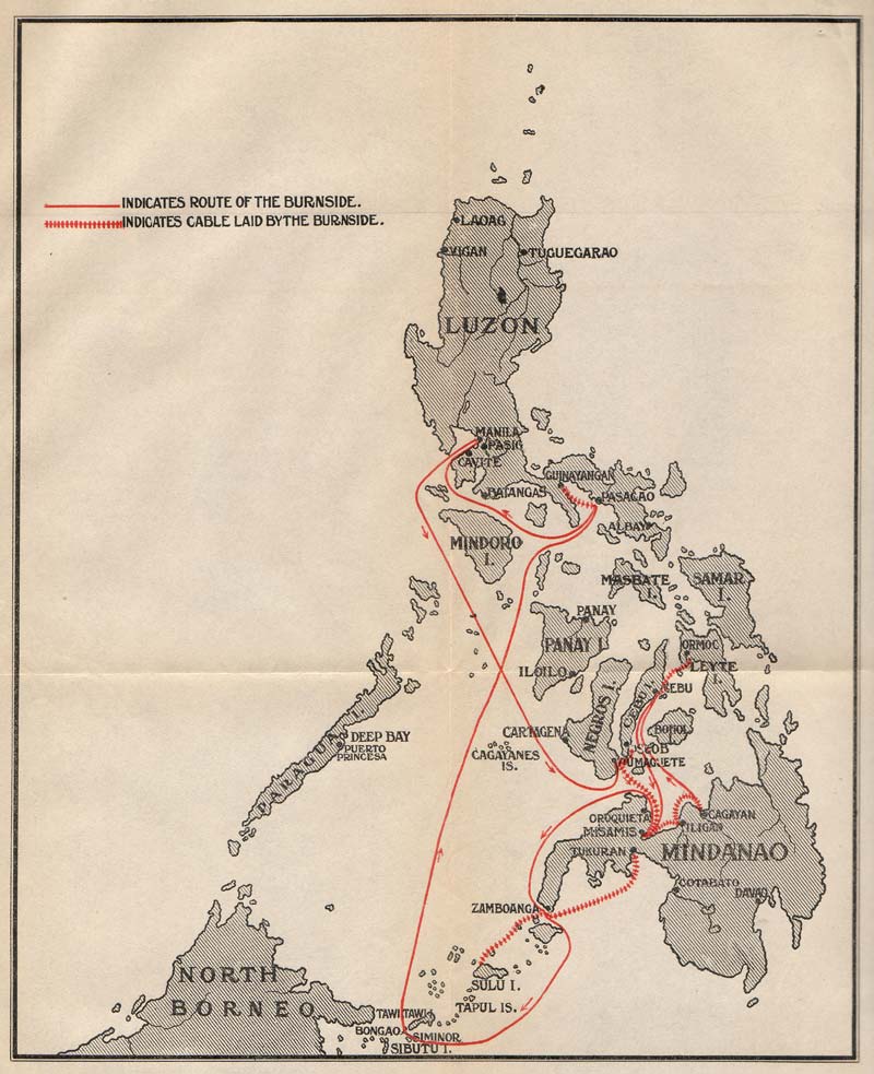
Map of the Philippines, showing route of
the cable laid by CS Burnside in 1901, |
|
|
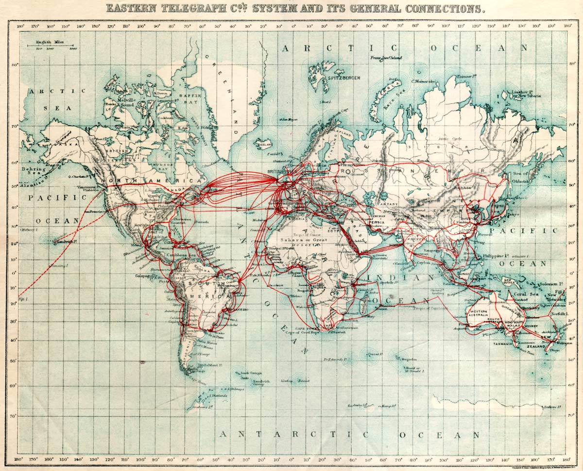
1901 Eastern Telegraph Company System Map
North Atlantic detail of above map |
|
Carte générale des grandes communications télégraphiques du monde, 1901/03 Map images courtesy of the
North Atlantic detail of above map
Great Britain detail of above map |
|
|
1902 British All Red Line map, from Johnson's |
|
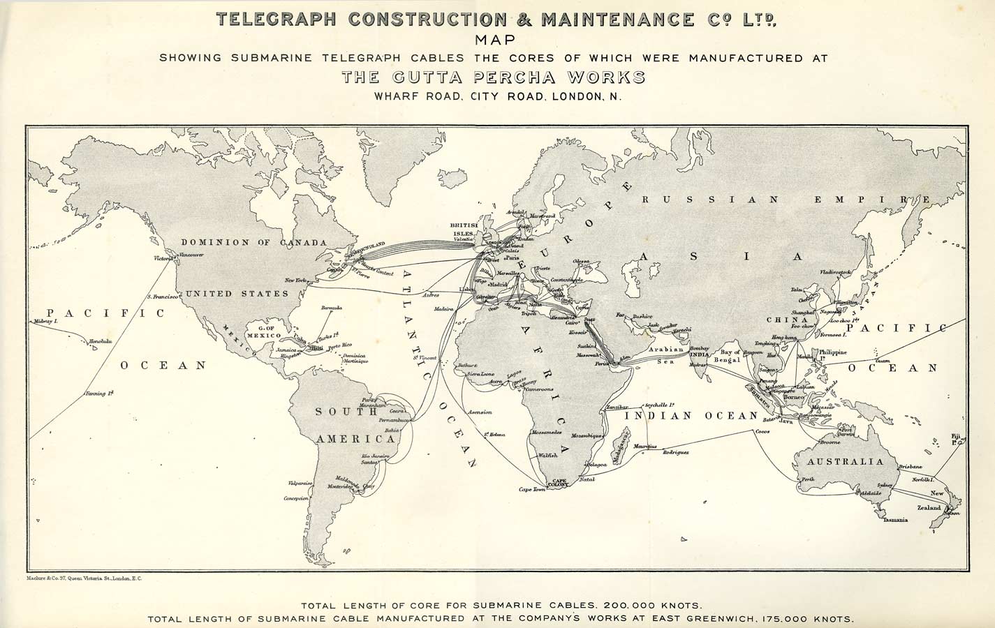
1903 Map: Telegraph Construction & Maintenance Co Ltd |
|
|
1904 Karte des Weltkabelnetzes (Map of the World Cable Network) |
|
|
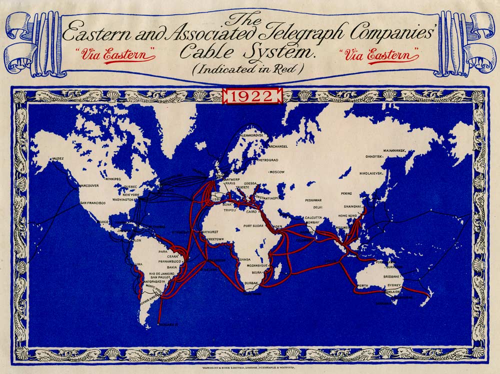
Move your mouse over the image to see the changes in the
cable routes from 1872 to 1922. Click here for a larger version of the 1922 map
1872 and 1922 Eastern & Associated Route Maps |
|
|
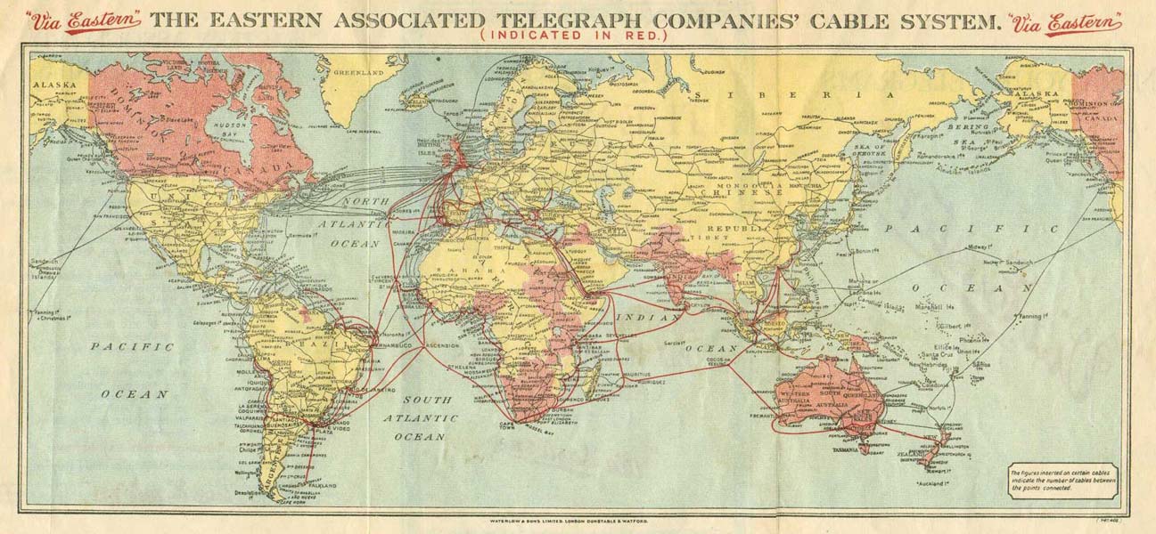
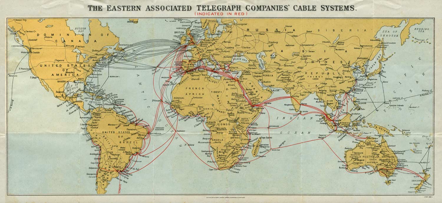
c.1924: The Eastern Associated Telegraph Companies' Cable System map |
|
|
|
|
|
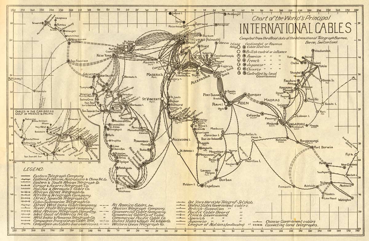
1924 International Cables map from Schreiner:
Cables and Wireless |
|
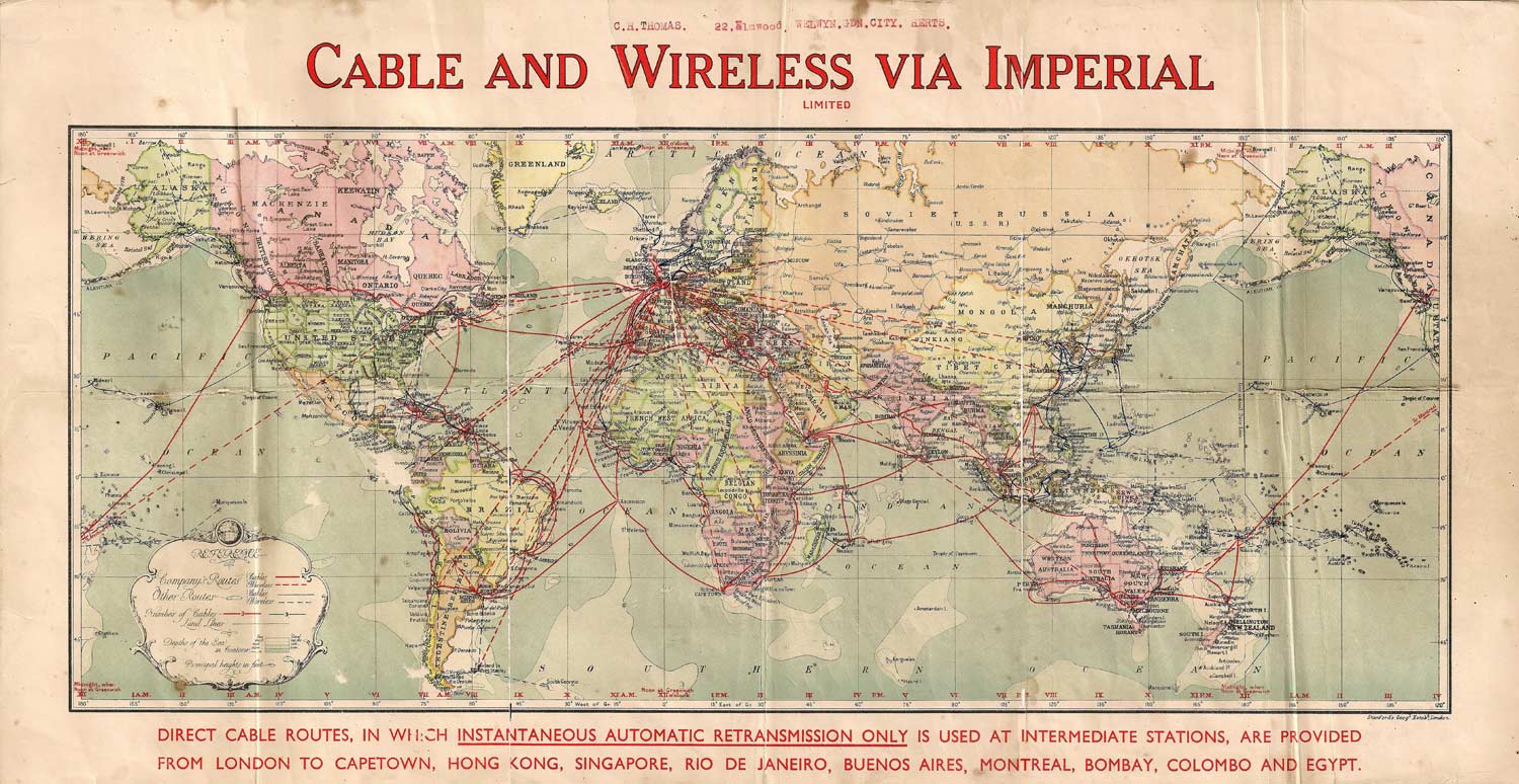
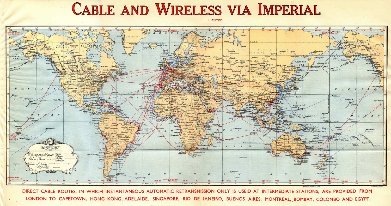
Cable and Wireless “Via Imperial” map. Undated, but post-1935 |
|
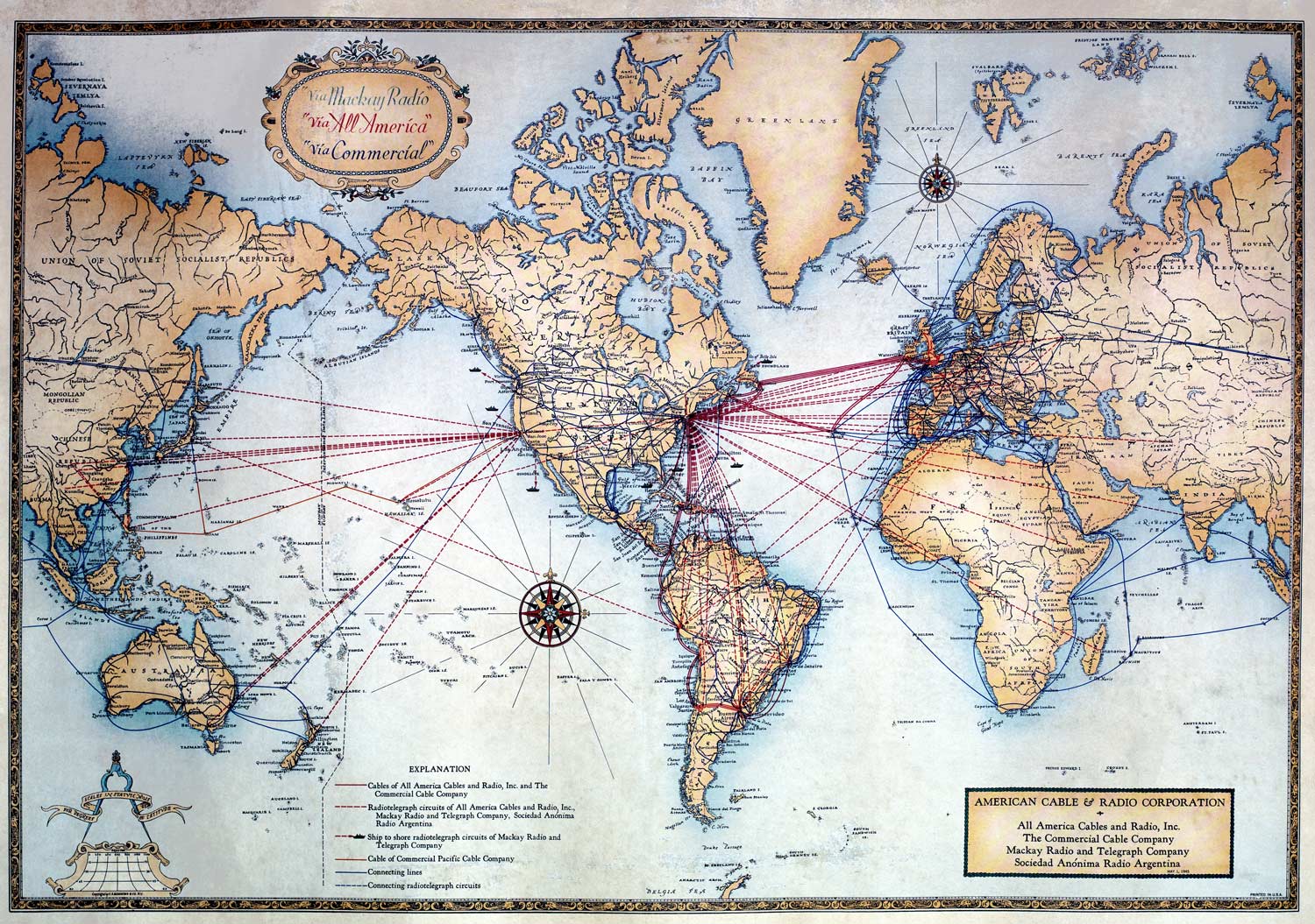
1945 American Cable & Radio Corporation map |
|
|
1947 Cable and Wireless “Via Imperial” map |
|
|
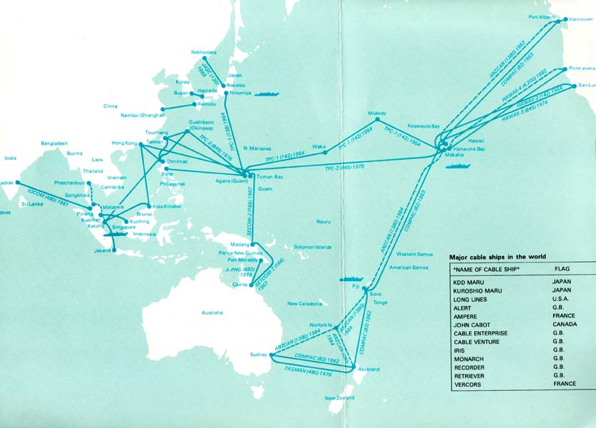
1982 Pacific region cable map |
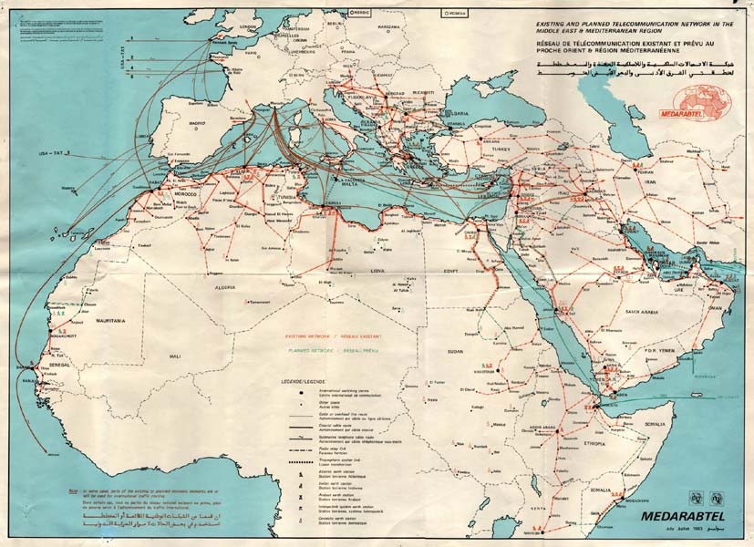
1983 MedArabTel map of the existing and planned telecommunication network in the Middle East and Mediterranean regions |
|
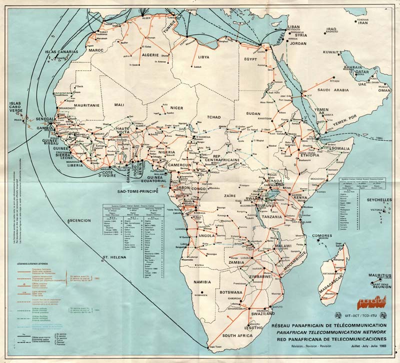
1983 PanAfTel map - PanAfrican Telecommunication Network |
|
|
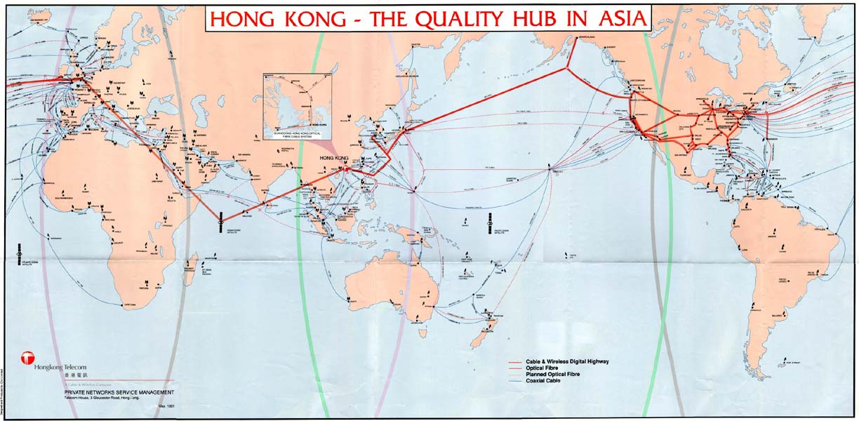
1991 Hong Kong Telecom map of Asian cables |
|
|
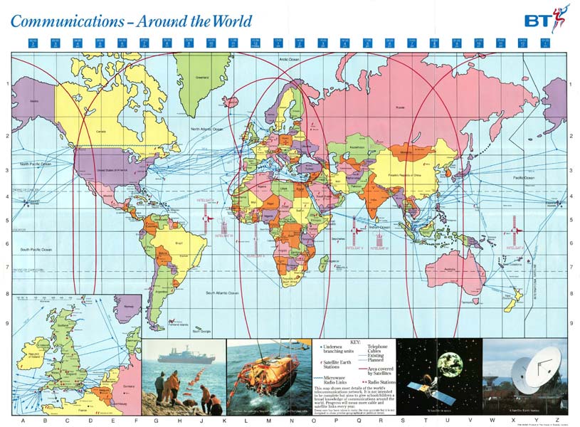
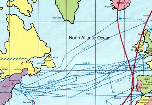
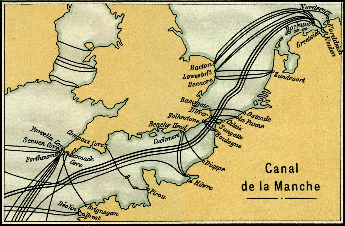
1992 British Telecomm map of |
North Atlantic detail of BT map |
| Anglo-American,
Eastern Associated, Hong Kong, MedArabTel, Pacific, PanAfTel, and British Telecomm maps courtesy of Bill Glover |
|
|
Last revised: 29 September, 2020 |
|


